Results for Camping
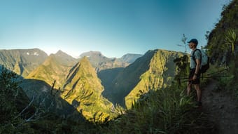
Hike the iconic trails of Réunion Island with this comprehensive guide to the GRR2, or Sentier de Grande Randonnée R2. This trek showcases the island's diverse landscapes, from lush coastal forests and volcanic plains to the dramatic cirques and the highest peak in the Indian Ocean, Piton des Neiges. The route is split into 8 flexible stages that can be completed in 7-12 days and is designed for those seeking to experience both wild camping or stays in the island’s charming gîtes. Along the way, you will encounter remote villages, stunning viewpoints, and the unique flora and fauna of Réunion. This guide provides all the necessary information, including the best camping spots, gîtes reservations, how to get there, when to go, trail conditions, weather, geography, and much more.
What this guide includes:
- A flexible itinerary for different lengths and difficulty levels
- Distances, best overnight (camping) options, and other useful waypoints
- Custom Google Maps with all the important locations, such as campsites, water sources, grocery stores, airports, trails, public transport stops, and viewpoints
- GPX-tracks of all the routes
- Practical information on how to get there, how to get around, when to go, trail conditions, weather, geography, and more.
- Detailed descriptions of the trekking route, including landmarks, terrain, and elevation changes.
Get an impression on YouTube.com/HarmenHoek
Backpacker • Adventure • Camping • Budget • Outdoors • Photography • Slow Travel
$15.00
21
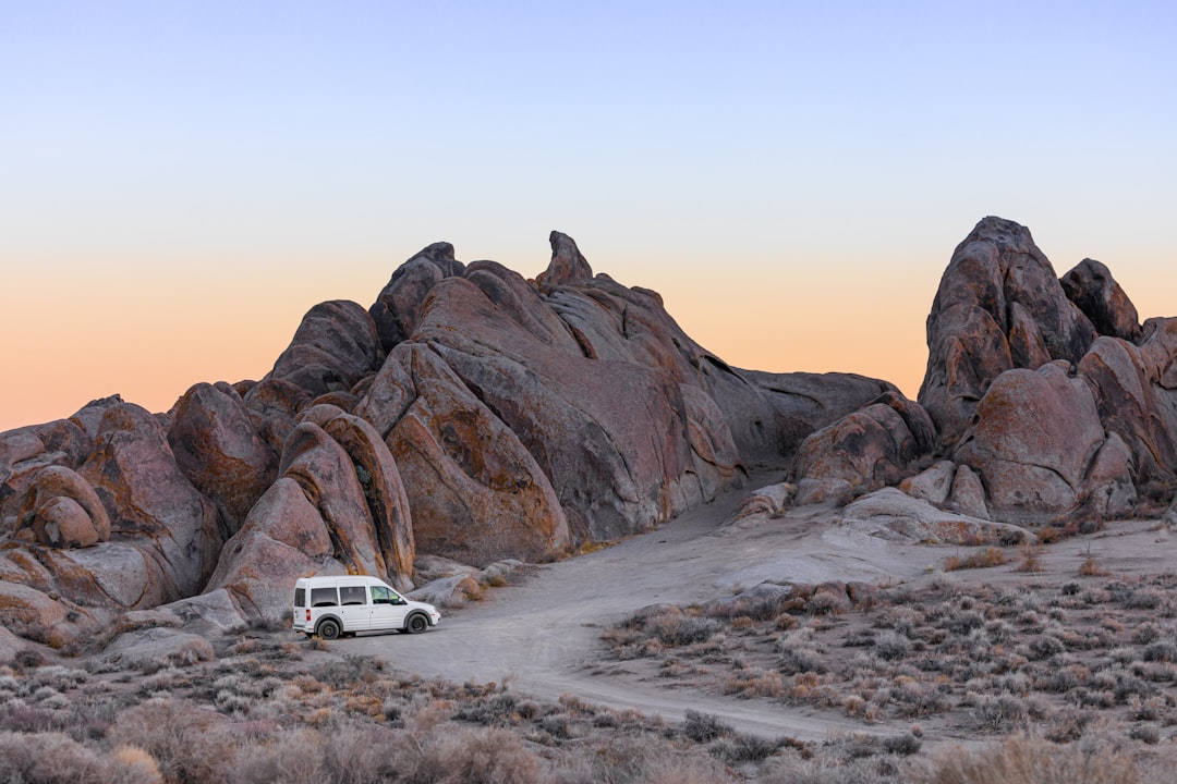
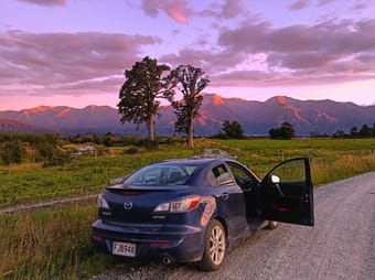
Don’t let Hwy 1 have all the fun. This route has great camping, mountain views, hot springs, and eclectic roadside stops. Make a plan to check it out on your next CA trip or long weekend. This List was made in partnership with Luno. Check out their car camping gear for your trip! You can shop their gear at https://lunolife.com or check out their Thatch profile at @luno.life
Free
14

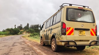
Camping is a great way to experience Kenya’s natural wonders. Our database of campsites in Kenya makes finding the perfect stops for your trip easy! We’re always adding new sites and updating information about roads, prices, and amenities. Always check with the campsite ahead of time to confirm the exact location and that it will be open during your visit. If you're looking for an easy way to travel and camp in Kenya, visit our website to rent a roadtrip-ready campervan! www.kambucampers.com
Families • Digital Nomads • Backpackers • Vegan • Vegetarian • Solo Female • Couples • Groups • Adventure • Budget • Wellness • Nature • Overlanding • RV • Sustainable/Eco • Van Life • Road Trip • Beach • Mountain • Camping • Relaxation
Free
13
California’s most visited park offers a variety of different accommodation options, both inside of, and just outside of the park. It’s often hard to get reservations inside of the park unless you book super far in advance, so if you aren’t one of those lucky ones, don’t worry, there are lots of really incredible spots within a short drive to the park entrance. This List showcases our favorite places to stay both in and near the park for every type of traveler - whether you’re looking for luxury, backcountry camping, or somewhere between 🏕
Backpackers • Couples • Groups • Solo Female • 50+ • Adventure • Luxury • Budget • Nature • Camping • Relaxation
Free
13

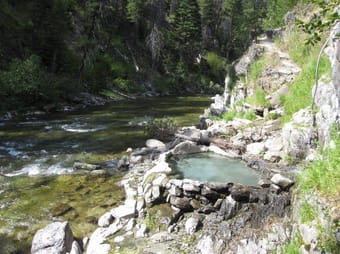
With 62% of it’s land listed as public land, Idaho is the perfect place to take your Luno gear for a car camping road trip. It’s also full of incredible geothermal hot springs, it seems, almost everywhere you turn. Here are some of our favorites, and nearby campgrounds for you to stay in when you soak.
Car-free • Nature • Camping • Relaxation • Hot Springs • Roadtrip
Free
8
Don’t let Hwy 1 have all the fun. This classic California road trip has great camping, Mountain View’s, hot springs, and eclectic roadside stops. Plan to check it out on your next trip to California, or long weekend! This List was made in partnership with Thatch.
Couples • Groups • Roadtrip • Camping • Mountain • Relaxation • Nature • Photography • People & Culture • Foodie
Free
6
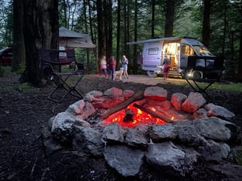
This week, we venture into one of our favorite destinations in West Virginia: the lovely renaissance town of Thomas, and the surrounding Monongahela National Forest. This region offers a perfect mix of front-country attractions, and backcountry scenery and adventure. We spend some time camping with our friends, @family_adventures_overlanding, and then take the Jeep out touring among the rhododendrons!
Couples • Groups • Adventure • Nature • Camping • People & Culture • Slow Travel
Free
6
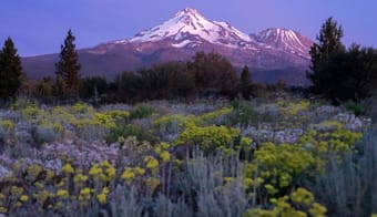
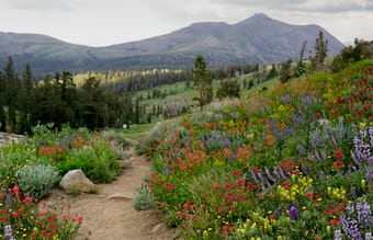
The Shasta-Trinity region of California is one of my favorites & really deserves to be visted more. This area is great for all types of adventurers. There's a lot to do if you're really into outdoor recreation, but there's also a lot you can see by parking at viewpoints, walking short trails, or simply driving around, so it's great for all levels of activity.
This is a really great area to visit during any season, but its worth keeping in mind that summer can be hot at lower elevations. That said, there's also some great swimming spots for cooling off. In the winter, the lower elevation areas can be in the 50s, and Shasta will have more snow on it, which looks really beautiful. In the Spring you get wildflowers, and in the Fall you get Fall colors.
This guide includes everything you need for a 4-7 day trip to this region. If you don't have that much time, you can choose what you'd like to do & come back again to do the rest! It includes details for camping, hotel accommodation, view points, hikes, food & drink, and all the reasons I love this area.
Nature • Sustainable/Eco • Mountain
$25.00
5
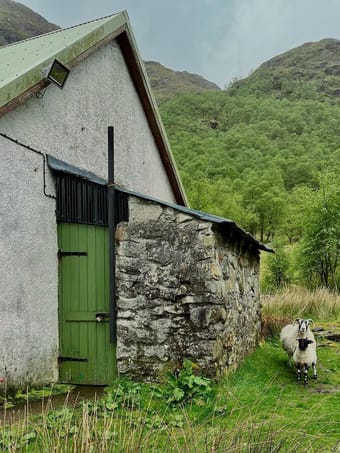
Scotland - the land of iconic views, food, and a FANTASTIC campervanning destination. We campervanned here for two weeks with this itinerary and had such an amazing experience. This guide covers 14 days and a whole lot of campervanning - get ready for a roadtrip! It covers the following destinations:
- Glencoe
- Isle of Skye
- NC500
- The Cairngorms
- Aberdeen
- Edinburgh
- Glasgow
& MANY destinations and things to do in between these major stops.
For some places it includes restaurants (but not all, as it's a campervanning itinerary so you'll likely be cooking most of your meals), lots of adventure (hikes, views, and activities), where to stay (parking your campervan is SO easy in Scotland we've included where to look for camping spots and also included campervan sites to hook up to for each spot), and inside intel on what you should know before you visit.
This itinerary is for the adventurous and people who want to get BUSY during their time here to see as much as possible. It includes quite a bit of driving and lots of activities. Whilst this itinerary is jam-packed, you can easily choose what you want from each day to give you more downtime, and spread some of the activities over multiple days to cut down on your driving time - it's very easily manipulated to suit your needs.
Family • Backpacker • 50+ • Couples • Digital Nomads • Female Solo • Adventure • Architecture • Camping • Foodie • Outdoors • Overlanding • Relaxation • Road Trip • Van Life • Photography • RV
$12.00
4
Nikki | Weekend Postcards
Available for hire
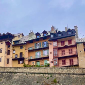
A Weekend in Briançon | Experience Briançon, France like a local
Hi fellow travelers! Thanks for stopping by to check out this guide with over 40 places to check out in the greater Briançon region.
Tucked away in the heart of the giants, the quaint city of Briançon is full of breathtaking mountain views, delicious boulangeries, and tons of outdoor adventure activities for the adrenaline addict in the family.
In this destination guide, you will get a sneak peek into what it's like to live like a local in Briançon. From our favorite restaurants, to various adventure options, this guide has it all. Come along with us as we explore the area with local resident Alexandre, who I had the pleasure of spending a month with. Due to staying with a local, I did not include recommendations of where to stay. There are a variety of options from Hotels, Airbnb's, Gîtes, and camping in the surrounding area. During the high tourist season, places can book up quickly so be sure to make your accommodations in advance.
---
All year round you can find activities to do in Briançon, but peek summer tourist season starts in late June, July, August, early September, and the winter tourist season begins in late December and runs until the end of March. Some activities listed in this guide are seasonal and are not open year round. Always check before booking a trip.
Things to note: Briançon is located part in the valley but is full of hills and steep climbs. This is a very walkable city designed for the outdoor enthusiast, nature lover and sports participant.
This is a live guide and will update as information changes in real time.
Backpacker • Car-free • Groups • Female Solo • Family • Digital Nomads • Couples • Adventure • Mountain • Slow Travel • Nature • Budget • Outdoors • Road Trip • History • Foodie • Photography
Free
4
California Gold Country holds an incredible amount of history, beautiful outdoor activities, alpine lakes, hiking, food, wine, & more. In my opinion, this section of Highway 49 is the best road trip in the West. The entire 49 is amazing, but in case you're short on time, this guide focuses on my favorite section of it.
This guide holds everything you need for a 3-5 day trip in this region. It includes information on hikes, swimming spots, small towns, wine, food, history, accommodation, camping, and more. That amount of time will leave you space to have at least one full outdoors day, one full wine & food day, and some other activities in between.
It's a great trip for someone like me who likes getting dirty & spending time outside and in the backcountry, but also likes really good food and some of the best wine California has to offer. There's something for everyone on this trip. You can walk on a dirt trail for an hour and a half, see wildflowers, swim, go wine tasting, learn about history, and more.
This trip can be done any time of year. If you visit in the winter, you may want to sub out some skiing for swimming & some of the hikes might be inaccessible without snowshoes or XC skis. If you go in the middle of summer, it will be hot at lower elevations, but still amazing. Spring will give you some incredible wildflowers.
This area is less frequented & should be appreciated. It's a great trip if you're looking to escape the crowds. This trip can easily be done as an add-on to Lake Tahoe or Sacramento.
Use this guide as a set itinerary, or draw from it to create your own trip!
Backpackers • Solo Female • Couples • Groups • Adventure • Architecture • Art • Boutique • Budget • Luxury • Foodie • Wellness • History • Shopping • Design • Nature • Overlanding • RV • People & Culture • Romantic • Sustainable/Eco • Slow Travel • Photography • Roadtrip • Wine • Coffee • Beach • Mountain • Camping • Relaxation
$25.00
4
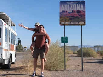
Don't spend all of your valuable free time researching what to do in Arizona! We have done it for you!
After our own research, suggestions from the locals, and 42 days in the state, we have compiled this guide of the best camping spots, things to do, and what to look out for while you explore the state!
The information in this guide is the direct correlation of our roadtrip through Arizona from North to South. (If your route will be different, this guide may be more useful in map mode)
If you've been looking for the best of Arizona, you have arrived.
Backpackers • Solo Female • Couples • Groups • 50+ • Roadtrip • Adventure • Nature • History • People & Culture • Photography • Foodie • Camping
$10.00
3
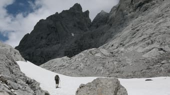
Seven-day trek based in refugios.
INTRODUCTION
The Picos de Europa is a region of limestone peaks reaching over 2500 metres above sea level; the highest being Torre de Cerredo at 2650 metres. The route described here is one that I hiked alone in early summer. The best time to tackle the route is between June and September. There is more likely to be snow on the high passes in early June but they are usually not to difficult to negotiate.
The Picos de Europa is not as well known as the Pyrenees or Alps and as such the hiker traffic is less and the tourist infrastructure is less developed. This makes the area feel less spoilt but it can also make it a more challenging area to explore with fewer trails and little to no signposting. Always take a map with you: the Editorial Alpina 1:25,000 maps are the best. I took these and also used the outdooractive app and downloaded the relevant map tiles. This is useful for pinpointing where you are, in what can be confusing terrain. I was lucky to have clear weather for my entire trek but I would imagine that it's pretty difficult to navigate when the cloud is down on the mountains so take a compass too.
You can stay in refugios every night on this hike and wild camping is permitted above 1500m; details below.
I can't recommend the Picos de Europa as a hiking destination enough. The mountains are magnificent but there are also beautiful extensive woodlands at lower altitudes, as well as meadows full of wildflowers and butterflies. The juxtaposition between the stark limestone peaks and the gentle greenery of the valleys is beguiling.
DISCLAIMER: Please note that hiking in the Picos de Europa is not risk free. It is a very challenging area in which to hike. I accept no responsibility for any accidents you may experience while hiking this route. You are responsible for your own safety. Some of the dangers and difficulties are listed a little further down this guide.
HOW BUSY?
Unlike some of the more well know hikes around Europe this trail is less well trodden and as such the trail can be quite hard to follow at times, and at other times there is no trail! Despite this, refugios, being small, fill up fast (see below).
REFUGIOS
The hike is made easier if you stay in the staffed refugios where you can recharge your metaphorical batteries. Accommodation at these mountain huts is in communal dormitories and you will need to bring your own sleeping bag. It's best to book ahead as they are often full throughout the summer. Prices are around the €12-17 mark and they also do affordable meals (breakfast, picnic lunch and dinner).
There is also a handful of unstaffed, very basic mountain shelters with no services and no beds but these can be a good option in an emergency. Most of the refugios only accept cash so be sure to take plenty with you before you set off as there are no ATMs! All the refugios on the route are listed in the route description below with website links.
WILD CAMPING
Camping is only permitted at 1500m above sea level or higher. There is not much water anywhere above this altitude so be sure to fill up when you get the chance (at refugios) before camping in a remote spot.
POSADA DE VALDEON
This beautiful village tucked in the valley between the Macizo Central and Macizo Occidental is a lovely place to wander for a few hours. At the centre of the village there are a number of restaurants and bars and a small square with a water fountain. If you need somewhere to stay before or after the trek you'll find hotels, guest houses and a youth hostel. There is a hotel recommendation and link in the route description.
In the centre of the village is a pharmacy should you need any blister plasters! And on the road to the west of the village is the National Park office where you can find information about hiking and anything else to do with the national park.
GETTING THERE
From the UK there are Ryanair flights to Oviedo (Asturias airport) from London Stansted. A bit further afield you can get flights to Bilbao and Santander from the UK and the rest of Europe. Getting from the airport is a little complicated but there are buses to Posada de Valdeón from Oviedo changing in Cangas de Onis. The journey takes about 4.5hrs. There are also buses from Santander and Bilbao changing in Llanes and Riaño with the journey taking around 15hrs from Bilbao.
An easier but more expensive option is to get a taxi. You could also hire a car but of course you will have to leave the car sitting idle in Posada de Valdeón while you do the hike.
FLORA & FAUNA
This area of northern Spain is fantastic for wildlife. At lower elevations the beech and sessile oak woodland stretches for miles over rolling hills. This is part of the boreal forest that once would have covered much of Europe and is home to roe deer, wild boar, red squirrels, pine martens and brown bears.
In the skies you have a good chance of seeing griffon vultures, golden, booted and short-toed eagles, black kites and peregrines. Of the smaller passerine species the Picos are home to red-backed shrikes, black redstarts, spotted flycatchers and black woodpeckers.
But it's the wildflowers in the meadows and on the woodland edges that are the real joy and most easily appreciated. Vetches, cinquefoils and orchids create a colourful patchwork of colours with butterflies bringing the whole scene to life. Look out for swallowtails, fritillaries and hairstreaks.
NAVIGATION
Navigation is difficult as the terrain can be confusing and in many places there is no trail whatsoever. Take a map (1:25K Editiorial Alpina maps are the best), compass and GPS and know how to use them. It's also a good idea to download the map on a relevant map app. I used the outdooractive app but others are available.
WEATHER
Thunderstorms are common, usually in the afternoon and these can be particularly dangerous high up in the mountains. It's best to hike early and get to a refugio by lunchtime if there are afternoon thunderstorms in the forecast. The weather in this part of Spain is very changeable as it has a maritime climate. Rain and thick fog are possible but equally long periods of warm sunshine are not unusual. The best advice I can offer is to be prepared for anything. Pack suncream and a sunhat but don't forget your waterproofs either.
FALLING ROCKS
Rock falls are not unusual as chamois and other hikers can dislodge rocks above you. Getting caught in a rockfall is not so common but not impossible. Be aware and if you see rocks heading your way, and cannot find cover, crouch down on the floor and pull your rucksack over your head and back.
DRINKING WATER
There is very little running water as these mountains are mostly comprised of permeable limestone. You will need to take plenty of water with you each day (I packed three litres every day and usually drank it all). You can fill up at the refugios and there are a few fountains / fuentes although most of the ones I saw marked on the Editorial Alpina map were dry when I found them.
THE SUN
Sunburn and sunstroke are both real dangers and there is little shade. Keep hydrated and wear a sun hat that covers your neck.
TERRAIN
In some places you need to scramble up steep rocky sections. You will need to have experience in this kind of terrain and have a head for heights! The terrain is very rocky and uneven at higher altitudes so you will need strong, sturdy footwear. Trekking poles are also invaluable in providing support and helping you across and up awkward sections. There is also a lot of steep ascent and descent on this route so you will need to be reasonably fit.
DANGEROUS ANIMALS
On many parts of the trail you will encounter cows. In my experience they are very docile and used to trekkers so they shouldn't be of any concern. You may also find flocks of sheep and while these aren't dangerous they are often accompanied by shepherd dogs which have been trained to keep intruders away from the flock. They can be quite intimidating when they start barking at you. If you see sheep ahead it is best to give them a wide berth, even if this means veering away from the trail for a while. If you walk directly towards or through a flock of sheep you risk agitating the shepherd dogs.
Bears are not common in the Picos de Europa but there are bears in other parts of the Cantabrian Mountains, notably Somiedo National Park, not far to the west, and there is always the possibility of seeing an itinerant bear wandering through the Picos. Eurasian brown bears are not as big nor aggressive as the grizzly bears of North America so you shouldn't worry too much about an encounter. It's extremely unlikely you will see one so if you do, consider yourself very lucky.
Wild boar are common in the woodlands at lower altitudes. They are not as aggressive as some people will tell you and tend to be nocturnal. I did see some in the daytime near Vegabaño. As soon as they saw me they ran away, crashing through the undergrowth. As with any large animal it's best to simply give them plenty of space to move away from you.
I hope none of this advice puts you off hiking in the Picos de Europa. Yes, it's a challenging mountain area but the rewards for hiking here are great. Enjoy the hike!
Adventure • Nature • Slow Travel • Sustainable/Eco • Mountain • Camping
$12.00
3
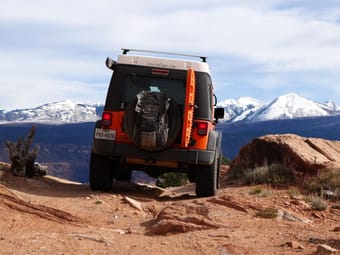
In this episode of venture4wd, I take my Jeep out into Moab's backcountry to explore obscure 4x4 tracks, take in the amazing, rugged sandstone scenery, and enjoy a night of camping under a wall of red-rock. I inadvertently find myself traversing a more challenging section of trail, the Behind the Rocks 4x4 Safari Route.
Backpackers • Adventure • Nature • Camping
Free
3
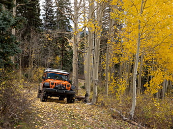
This episode kicks off in Pagosa Springs, where Shannon and I grab a bite to eat (or two) before venturing into the nearby San Juan National Forest, for some dispersed camping in our Winnebago Revel. Thereafter, I take my Jeep into the mountains to explore a winding forest road in mid-October.
Backpackers • Couples • Groups • Adventure • Camping • Nature • Foodie • Mountain • Roadtrip
Free
3
Having spent half a year on the island, I've had ample time to explore and discover a wealth of information. I'm excited to share my insights with all of you. This guide encompasses a recommended route along the entire island with my personal suggestions on food, camping spots, campsites, adventures, and much more. I try to collect some touristic highlights but mostly a lot of off the beaten path gems in this guide. I hope you enjoy!
50+ • Digital Nomads • Couples • Family • Adventure • Budget • Camping • Outdoors • Overlanding • RV • Road Trip • Van Life
$10.00
2
Beyond the well-trodden paths, this guide unveils the island's hidden gems, inviting you to discover enchanting waterfalls cascading through lush jungles, pristine beaches embraced by turquoise waters, and secluded diving spots teeming with vibrant marine life. Unearth the secrets of Cebu's nature. Whether you seek adventure or tranquillity, this guide ensures an immersive experience, blending tourist favourites with the island's best-kept secrets for an unforgettable exploration of Cebu's wonders.
Included in this Guide:
📍Recommended Tours
📍Waterfalls
📍Springs
📍Adrenaline & Adventure Activities
📍Snorkelling & Scuba Diving
📍Hiking & Camping
📍Beaches
📍Restaurants
📍Bucketlist Accomodation & Unique AirBnbs
Backpacker • Digital Nomads • Family • Female Solo • Couples • Adventure • Camping • Outdoors • Road Trip • Budget
Free
2
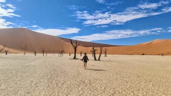
Few travellers will actually get to visit Namibia, but those who do will find somewhere quite unlike anywhere else on planet earth. Whether you want to see the rolling sand dunes of the Namib, the incredible wildlife of Etosha or the lunar landscapes of Spitzkoppe, Namibia has something to suit every traveller.
This guide is perfect for:
😍 First time travellers heading to Namibia
✈ Those flying in and out of Windhoek OR those doing a longer trip through Southern Africa
💰 Budget, midrange or luxury travellers (we cover all three styles!)
🚗 Those doing a road trip with their own car or planning to hire a car and self-drive
In this guide, we cover:
💲Know before you gos such as currency, tipping and connectivity
🚙 A full route for your trip, which can be adjusted to suit what's best for you!
🏕 Recommendations of hotels and best accommodation, as well as alternative options for camping
Don't forget to save the guide to refer back to later, and let us know what you think!
Emma
Camping • Budget • Luxury • Outdoors • Sustainable/Eco • Road Trip • Van Life • Overlanding
$10.00
2
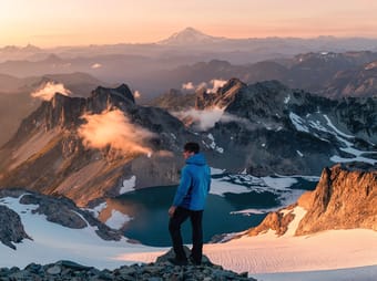
If you plan to visit Washington (or live there) and want to experience endlessly gorgeous hikes, this is the guide for you. It includes day hikes & overnight trail options. Unlocking this Board will get you lifetime access to a continuously growing list of all of my favorite Washington hikes. I will continue to add to it, as I accomplish more of them.
Details include hike locations, hiking routes, best times to visit, parking instructions, camping requirements, gear suggestions, photography tips, and general information. It's basically everything you need to conquer each hike & experience it to the fullest.
I highly recommend utilizing the map view to allow you to have a game plan to accomplish as many hikes as you'd like during the time you have.
Hiking enthusiasts • Outdoor adventurers • Nature lovers • Adventure • Nature • Hiking • Photography • Camping • Overnight Hikes
$15.00
2
Try ThatchGPT