The World's Most Iconic Long-Distance Trails
Discover the world's most iconic long-distance trails, from the majestic peaks of the Alps to the spiritual paths of the Camino de Santiago. This guide explores unforgettable hikes that blend natural beauty, cultural immersion, and personal challenge. Whether you're a seasoned trekker or a first-time adventurer, find inspiration, planning tips, and expert insights for your next great journey.
Liv Coning
Marketing Lead
Dec 17 2024
The World's Most Iconic Long-Distance Trails
For adventurous souls seeking to explore the world on foot, these legendary trails offer unforgettable experiences through some of Earth's most stunning landscapes.
Why Take On a Long-Distance Trail?
Ever wondered what makes people pack up their bags and hit trails for days or weeks at a time? It's pretty amazing what happens when you slow down and explore the world on foot. You're not just passing through - you're really living in these landscapes, getting to know the local communities, and giving yourself time to reset and reflect. Plus, there's something incredibly satisfying about challenging yourself and watching your strength and confidence grow with each passing mile.
The best part? Long-distance hiking might just be one of the most planet-friendly ways to travel. Think about it - you're basically leaving nothing but footprints while having a massive adventure. Instead of zipping through on trains or planes, you're taking it slow, supporting small local businesses along the way, and helping remote communities thrive through sustainable tourism. Many trails even use their fees to protect the very landscapes you're enjoying.
Whether you're looking to clear your head, challenge yourself, or just experience the world in a more meaningful way, these long-distance trails offer something that's hard to find anywhere else - a genuine connection with both nature and culture, one step at a time.
The Most Beautiful Long Distance Trails in the World

Tour du Mont Blanc (TMB)
Distance: 170 kilometers (105 miles)
Difficulty: Moderate to challenging
Best for: Experienced hikers with good fitness levels
Route: A circular trail through France (Chamonix, Contamines, Les Chapieux), Italy (Courmayeur, La Palud), and Switzerland (Champex, La Fouly, Trient) before returning to Chamonix, France
Best time: Mid-June to mid-September (avoiding snow)
Duration: 7-11 days
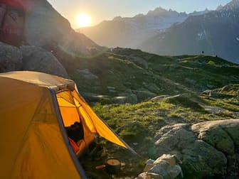
The Tour du Mont Blanc circles the Mont Blanc massif, taking hikers through three countries while offering spectacular views of glaciers, alpine meadows, and towering peaks. The trail features comfortable mountain huts and villages for overnight stays, making it a perfect blend of adventure and comfort.
Use this guide to help plan your trip:
Use this guide to help plan your trip:

Alta Via 1 (Dolomites High Route)
Distance: 120 kilometers (75 miles)
Difficulty: Moderate
Best for: Mountain enthusiasts and photographers
Route: Lago di Braies to Belluno, Italy
Best time: Late June to mid-September
Duration: 8-10 days
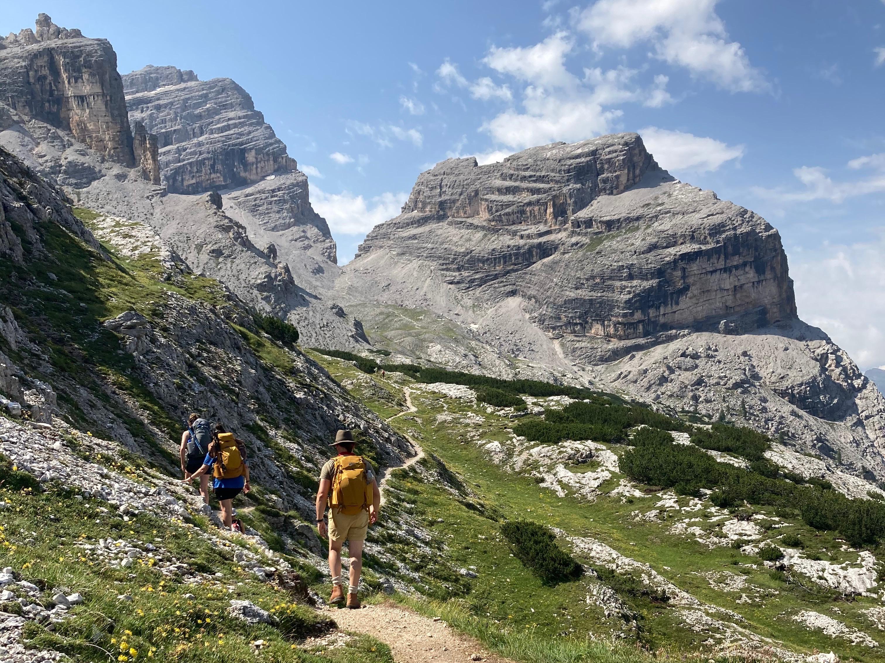
The Alta Via 1 traverses the eastern Dolomites, offering dramatic views of limestone peaks and pristine alpine landscapes. This well-maintained trail connects a series of rifugios (mountain huts), allowing hikers to travel light while enjoying authentic Italian mountain hospitality.
Use this guide to help plan your trip:
Use this guide to help plan your trip:

Camino de Santiago (French Way)
Distance: 780 kilometers (485 miles)
Difficulty: Easy to moderate
Best for: Cultural enthusiasts and spiritual seekers
Route: Starting in Saint-Jean-Pied-de-Port, France, crossing into Spain through the Pyrenees, then traversing the Spanish regions of Navarra, La Rioja, Castilla y León, and Galicia to reach Santiago de Compostela
Best time: April to June or September to October
Duration: 30-35 days for full route
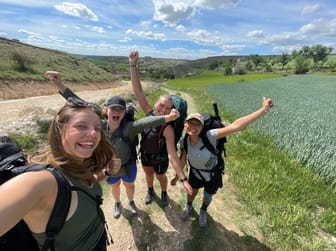
The most popular pilgrimage route in Europe, the French Way of the Camino de Santiago combines historical significance with natural beauty. Travelers pass through medieval towns, vineyards, and rolling countryside while experiencing Spain's rich cultural heritage.
Many hikers choose to break up the Camino into two sections, making it more manageable for those with limited time:
First Half: Saint-Jean to Burgos
First Half: Saint-Jean to Burgos
Distance: 285 kilometers (177 miles)
Duration: 12-14 days
This section features the challenging Pyrenees crossing, the famous wine region of La Rioja, and beautiful medieval towns. It's known for its dramatic landscapes and elevation changes.
Second Half: Burgos to Santiago
Second Half: Burgos to Santiago
Distance: 495 kilometers (308 miles)
Duration: 18-21 days
The second half includes the Meseta (Spain's central plateau), the rolling hills of Galicia, and the final approach to Santiago. This section is generally flatter and offers a more contemplative experience through Spain's heartland.
Use this guide to help plan your trip:
Use this guide to help plan your trip:

W Trek (Torres del Paine)
Distance: 71 kilometers (44 miles)
Difficulty: Moderate
Best for: Nature photographers and wilderness enthusiasts
Route: Circuit within Torres del Paine National Park, Chile
Best time: November to March (Southern Hemisphere summer)
Duration: 4-5 days
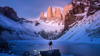
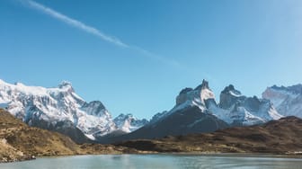
The W Trek showcases the best of Patagonia's dramatic landscapes, including the iconic granite towers of Torres del Paine, pristine glaciers, and turquoise lakes. The trail's W-shaped route provides access to some of the most spectacular viewpoints in South America.
Use these guides to help plan your trip:
Use these guides to help plan your trip:
Lena Müller
Beautiful Patagonia: Your complete travel itinerary to the W-Trek in Torres del Paine ⛰️🥾
Embark on an unforgettable Patagonian adventure with the W-Trek in Torres del Paine National Park. This iconic trail leads through awe-inspiring landscapes of rugged mountains, glaciers, and turquoise lakes. My guide provides essential tips for planning, from choosing the ideal time to packing smartly. Whether you're an experienced hiker or a nature enthusiast, the W-Trek offers a once-in-a-lifetime journey into the heart of Patagonia's wilderness. Get ready for the trip of a lifetime!
This guide includes:
☀️ Best time to travel to Torres del Paine
🚌 How to get to and around Torres del Paine
🇨🇱 A guide to Puerto Natales (the door to Torres del Paine)
🗺️ A day-by-day itinerary with my recommended route (as there are a couple of different options)
🥾 A detailed packing list
🏕️ Information on Campgrounds and links to the reservation systems
& Landscape photography from around the W-Trek as well as four videos of my experience doing the trek in 2018 📸🎥
$20.00
5

Annapurna Circuit
Distance: 230 kilometers (143 miles)
Difficulty: Challenging
Best for: High-altitude trekkers and cultural enthusiasts
Route: A circular trek through Nepal's Annapurna region, passing through the districts of Lamjung, Manang, Mustang, and Myagdi
Best time: October to November or March to April (avoiding monsoon season)
Duration: 14-21 days
This Himalayan trek offers breathtaking mountain views, ancient Buddhist temples, and traditional Nepali villages. The trail crosses the challenging Thorong La Pass at 5,416 meters (17,769 feet).

Overland Track
Distance: 65 kilometers (40 miles)
Difficulty: Moderate
Best for: Wildlife enthusiasts and wilderness lovers
Route: Cradle Mountain to Lake St Clair, Tasmania, Australia
Best time: December to March (Australian summer)
Duration: 5-6 days
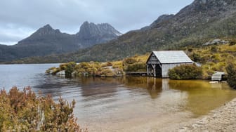
Tasmania's premier alpine walk traverses the heart of the Cradle Mountain-Lake St Clair National Park, featuring ancient rainforests, glacial mountains, and unique Australian wildlife.
Use this guide to help plan your trip:
Use this guide to help plan your trip:
ecoconscious travel
Available for hire
Lutruwita/Tasmania: Natural wonders, the Apple Isle, rugged nature
Lutruwita/Tasmania - Australia's southern-most island state - is a paradise for green travellers who love nature, adventure and yummy food. You can hike through amazing forests, join tours that respect the environment, and taste fresh food from local farms and markets. Want to know how to have a blast in Tasmania without hurting the planet? Check out our tips for eco-friendly travel in Tasmania.
Free
0

Cotswold Way
Distance: 164 kilometers (102 miles)
Difficulty: Moderate
Best for: History lovers and countryside enthusiasts
Route: Running along the Cotswold escarpment from Bath to Chipping Campden, passing through picturesque villages and historic sites in Gloucestershire and Somerset
Best time: April to October, with spring and autumn offering the most pleasant walking conditions
Duration: 7-10 days for full trail
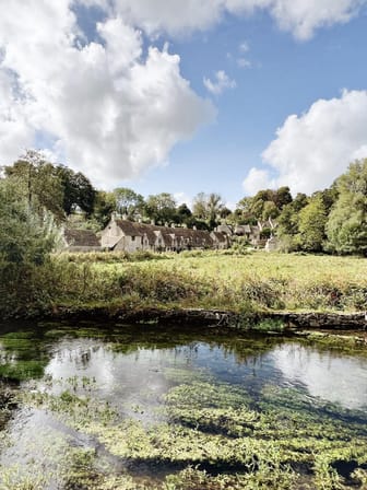
This quintessentially English trail winds through rolling hills and charming villages, offering spectacular views across the Severn Vale. The path features historic landmarks, ancient woodlands, and traditional honey-colored Cotswold stone architecture, with plenty of cozy pubs and B&Bs along the way.
Use these guides to help plan your trip:
Use these guides to help plan your trip:
How Thatch Local Experts Can Help Plan Your Trek
Planning a long-distance trek can be overwhelming, but Thatch's local experts are here to help you:
- Find the perfect hiking season based on local weather patterns and trail conditions
- Secure necessary permits and book authentic local accommodations along your route
- Create a personalized training plan to prepare for your specific trail
- Get expert gear recommendations for your chosen destination
- Navigate local customs, regulations, and find reliable guided tour options
Use our personal concierge, ThatchGPT, to help connect you with the right local expert for your trip.
Whether you're seeking spiritual enlightenment on the Camino de Santiago or challenging yourself in the Alps, these trails offer transformative experiences that combine physical challenge with cultural discovery and natural beauty.
**
Plan your next trip
with Thatch
With instant access to local expert knowledge in 80+ countries, Thatch makes it easy to plan unique, high-quality trips stress-free.
Get paid to share your
travel knowledge
Thatch makes it easy for thousands of travel creators in 80+ countries to organize and monetize their travel knowledge.
Learn More
