FREE: Triglav Lakes Valley HIKING GUIDE 🇸🇮
Where is Triglav?
Nestled in the northwestern corner of Slovenia, Triglav National Park is the country's only national park and a true gem for nature lovers. Officially established in its modern form in 1981, the park is named after Mount Triglav, the tallest peak in the Julian Alps. This majestic mountain sits almost at the heart of the park, surrounded by stunning valleys that branch out in all directions. These valleys are the birthplace of two major river systems—the Soča and the Sava—which flow all the way to the Adriatic and Black Seas.
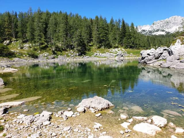
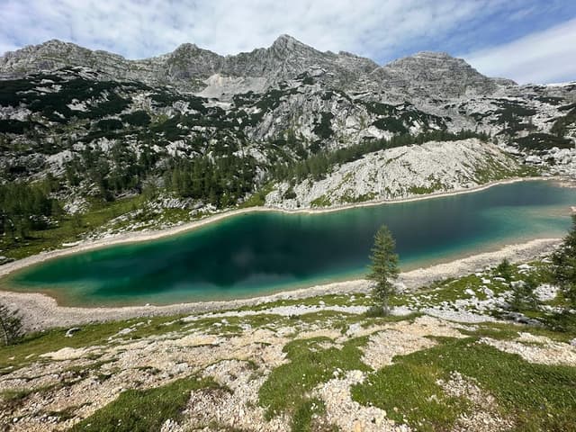
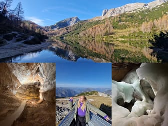
The park is also home to some breathtaking lakes. The lowest of these is Black Lake (Črno jezero), sitting at 1,294 meters above sea level, nestled just above the rocky Komarča Crag. This lake is home to the Alpine newt, a species native to the Alps. A bit higher up, beneath Mount Tičarica, you'll find the Double Lake (Dvojno jezero), two interconnected lakes at 1,676 meters. The largest and deepest lake in the park is Big Lake, or Lake Ledvica, which lies at 1,838 meters. True to its name, this kidney-shaped lake is a sight to behold. Finally, the highest lake in the park is Podstenje Lake, perched at an impressive 1,993 meters above sea level.
What to see besides Seven Lakes Valley?
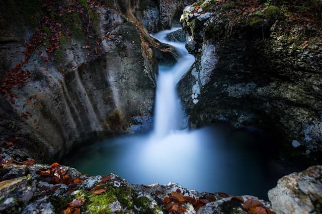
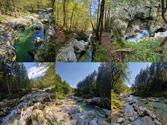
If you come a day earlier, you can go visit Korita Mostnice (Mostnice Gorge). It is a short 2 hour hike and it is circular and very easy!
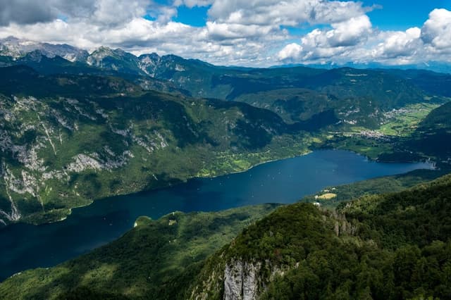
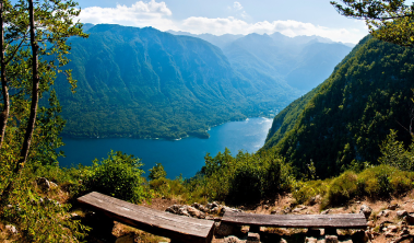
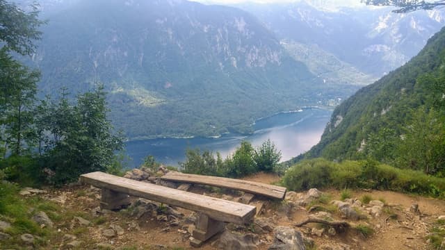
You can also walk around Bohinj Lake or take a swim😊
Where to stay?
A) in Bohinj county
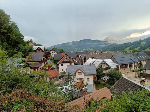
Thr BEST thing is to rent (via booking or airbnb) a place in Stara Fužina or Srednja vas.
B) on Mount Triglav
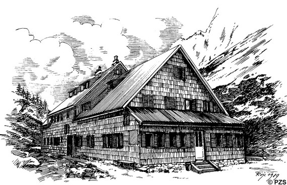
There are several mountain huts. We stayed in a hut called Koča pri triglavskih jezer. You have to reserve few months upfront because it fills up pretty quickly. We made reservation in March for August.
Note about Koča, the food was very expensive (15€ per meal that was just pasta and not very good), coffee is 3.50, beer 6-7 euros, desert also 6-7 euros...anyway, it is very expensive. Also, there are NO SHOWERS so take tissues with you. There are also NO sheets so pack something to sleep on or a sleeping bag. But all in all, it was okay, there were a lot of spiders but a beautiful view.
The starting point is at Planina Blato.
There are 2 options to get there:
1) BY CAR
Parking is 20 € per day but you can get to the very top. BUT, It gets crowded very early, like around 7-8 in the morning everything is already full.
Useful parking info here (there are some cheaper parkings where you can leave your car and go by bus).
2) BY BUS
Public transport to Planina Blato and other important hiking destinations is very organized. The bus goes every 2 hours from Senožeta (15 minutes by foot from Srednja Vas). It stops in Stara Fužina and drives straight to Planina Blato. It leaves you 700 m from the begining of the trail.
Ticket: 2€/24 h (in August 2024).
ADVICE:
Also, it is best to get there a day earlier so you can rest, explore Bohinj a little bit and chill.
We recommend to stop and eat at Gostilna Ema, large portions, after 17h (5 pm) there is only food from grill, before you can order pizza or something else.
PUBLIC TRANSPORT:
As I said, public transport are buses. During high season there are separate lines of buses that drive to all popular hiking routes and points of interest.
Ticket is 2 euros per person per 24h. You can buy it online and it is valid from the first activation on the bus.
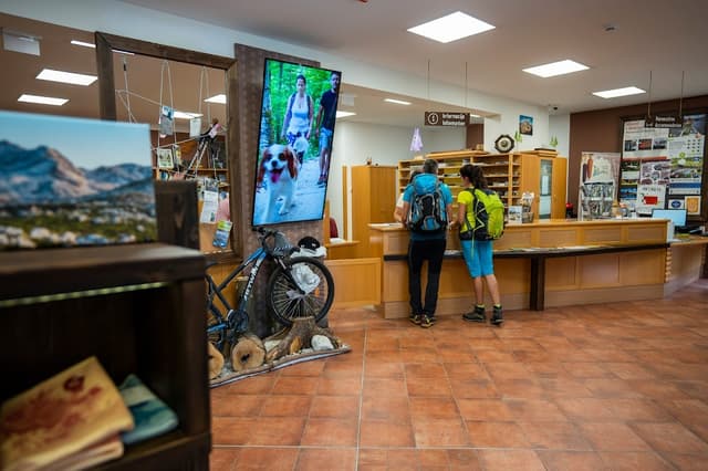
If you can't find some bus stop on Google Maps, the best is to go and ask in the central Tourist Information Centre in Bohinj. They will give you free maps and all necessary information that you need.
This is the website for the buses and where you can buy ticket:
IMPORTANT INFORMATION BEFORE GOING TO TRIGLAV:
-Download offline maps (Mapy.cz is the best app)
-Dress for hiking!!! Proper hiking shoes, hiking poles, backpack etc.
-Take a lot of water (at least 3 L per person)
-screenshot EVERYTHING or print it out on paper (reservations, maps, directions...)
-Take cash (some huts don't accept cards)
-THERE IS NO SIGNAL (no signal on Triglav so make sure that important people know where you are going)
-Emergency number: 112
-Check if you can make European health card (in Croatia is free, I don't know about other countries) or take travel insurance
-Take wet wipes and deodorant
-Enough food (especially if you are going for 2 or more days)
-Warm clothes (Triglav gets around 6-9 °C in summer at night)
-Head lamp if you plan to explore after dark
LET'S START:
Summarized route:
Planina Blato (1147m) (parking) – Koča na planini pri Jezeru (1453m) – planina Viševnik (1615m) – planina Dedno polje (1560m) – planina Ovčarija (1660m) – Koča pri Triglavskih jezeri (1685m) (preko Prodova, not preko Štapca)
Starting point: Planina Blato
To get there we took bus 5 from Senožeta Parking at 7:00 in morning. Already then the bus was full and it is more of a van than a bus. So get there early!
This is the location on Google Maps:

The bus drops you off at Blato-Vogar crossroad. If you go by car, this is where you can start to park. Parking is basically along the road like this:
Hike uphill cca 700 m and you will arrive at the beginning of the trail:
Do not get discouraged, but to be honest, this part was the hardest part of the hike. If you survive this, then you can survive the whole hike. You will be hiking for an hour to hour and a half, depending on your tempo. We hiked for an hour and something little and we are in moderate shape. Keep that in mind.
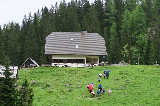
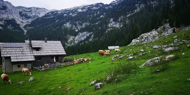
Koča na planini pri jezeru
Finally you get to Koča na planini pri jezeru. This is also one of the huts that you can reserve to sleep there.
There you can take a break before next stop. Warning, next stop is Dedno polje and there are also few steep parts. Hiking poles are obligatory to survive! But after that the rest of the hike is pretty easy and beautiful to enjoy 😊💙
Dedno polje
(Picture above: homemade štrukli from cow cheese)
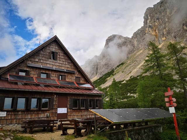
After Dedno polje, it is time to go all the way to Double Lake. Fill your water there because after Dedno polje, there is nowhere to fill up water before Koča pri Triglavskih jezer.
Planina Ovčarija
First you go to Ovčarija. It is a small valley with beautiful views.
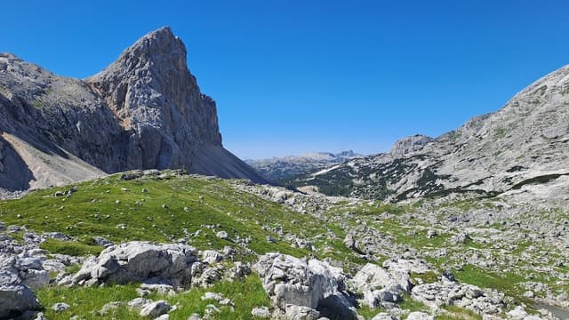
From there there are 2 ways to get to Koča. First is "preko Štapc" (which basically means across the mountains). This one is more challenging and it is only for hard core hikers because you literally climb a mountain. Second way is "preko Prodorov. This one goes around the mountains, itnis an hour longer but the views are insaine and beautiful.
View from Prodorov road:
The trail at one point is steep but managable with hiking poles. After an hour and a half you get to the sign:
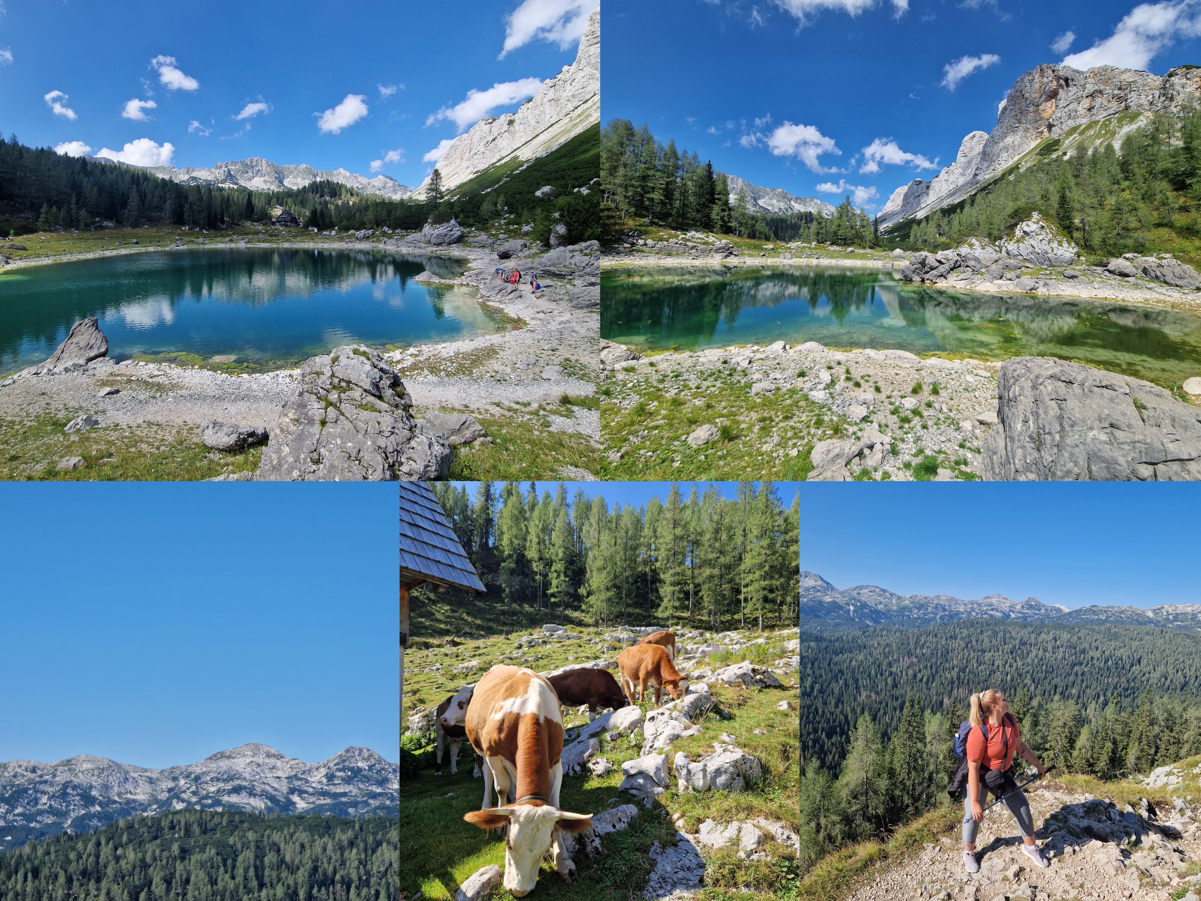
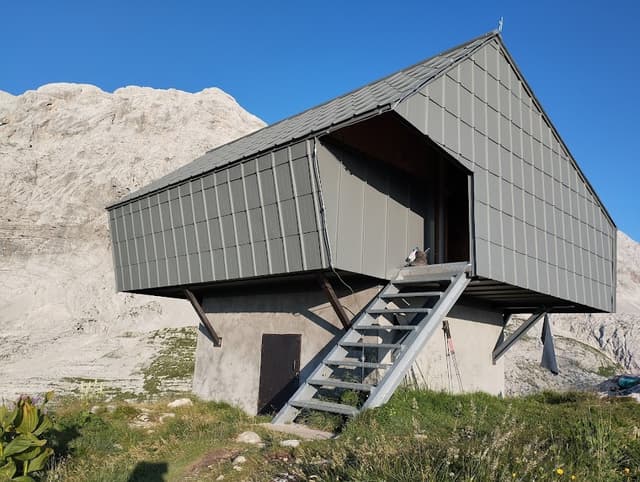
Koča pri triglavskih jezer
Finally, you get to Koča pri Triglavskih jezer. Rest there and enjoy.
Here are some photos of Koča pri Triglavskih jezer
This is the beginning of the valley. For us, this was the final stop but if you are more experienced, here are more routes to take to see more lakes:


Also, here are the details from our trail (you can open it in Mapy.cz or Wikiloc):
Places on the map:
I hope you enjoyed this guide! If you did, please subscribe, save, and don't forget to TIP if you found the information useful. 😊
The home for unique & authentic travel