Routeburn Track

Ask ThatchGPT
Suggest a local expert to plan my trip
Suggest an unique itinerary for my New Zealand trip
What foods do New Zealand locals eat
What are some true hidden gems in New Zealand
Help me brainstorm trip ideas for New Zealand
Help me plan a family-friendly trip to New Zealand
What people say
natalie bowler
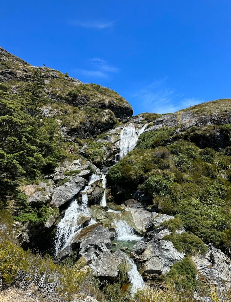
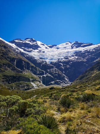
"We did this hike in november and it has to be one of my favourite ever. You can start the track either end at the routeburn shelter glenorchy side or the divide in te anau which is approx 3 hours from queenstown. If you dont have a car you can leave at either end or are unable to do a key swap with someone else walking this track (you can arrange these on the local FB pages) then there is a bus available also but it is a little expensive. We had a hire car so did a day hike half way and back which was the best alternative for us. We started at the routeburn shelter side and walked to harris saddle and back. This took approx 8 hours but we were walking fast... The whole hike takes approx 2-4 days as most people sleep at the huts along the way. There is a couple of longdrop toilets along the way also but make sure to go before you start or stop in at one of the huts. The routeburn falls hut is honestly one of the best DOC huts i have ever seen and is large with a lovely deck overlooking the mountains. Be aware these huts book up very fast which is partially why we did a day hike as it was fully booked during peak season. The views along the way will blow your mind. Ensure you pack well even just for a day hike with plenty of snacks and water, suncream and comfortable clothing/shoes. There is also a water hole to swim in if you are brave enough to face the icy cold mountain water. "
Read more in:
Sarah Geiger
Available for hire
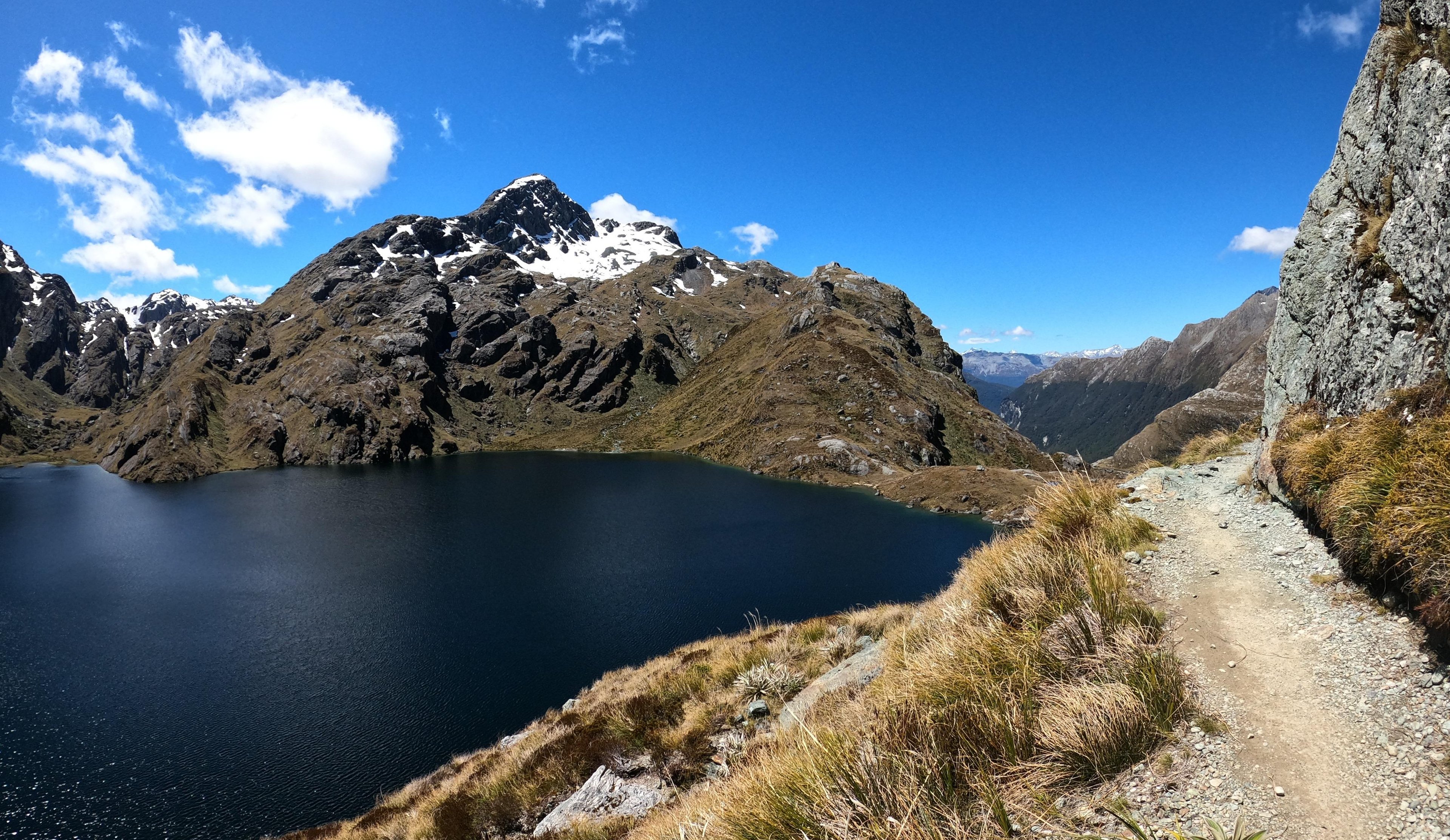
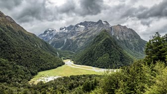
"This 33 km long multi-day hike offers spectacular views over mountains, valleys and the stunning Routeburn River. It is best done between November and April and as this is the Great Walk season you have to book the huts or campgrounds well in advance. The hike connects the Routeburn Shelter, that can be reached from Glenorchy, and the State Highway 94 (the road leading to Milford Sound) and it can be walked in either direction.
If you missed out on securing a booking and won't be able to do the entire track, it is also possbile to do some shorter walks there.
We spent an afternoon there, starting at the Routeburn Shelter and walking till we reached the Forge Flat, on the way back we did the Routeburn Nature Walk.
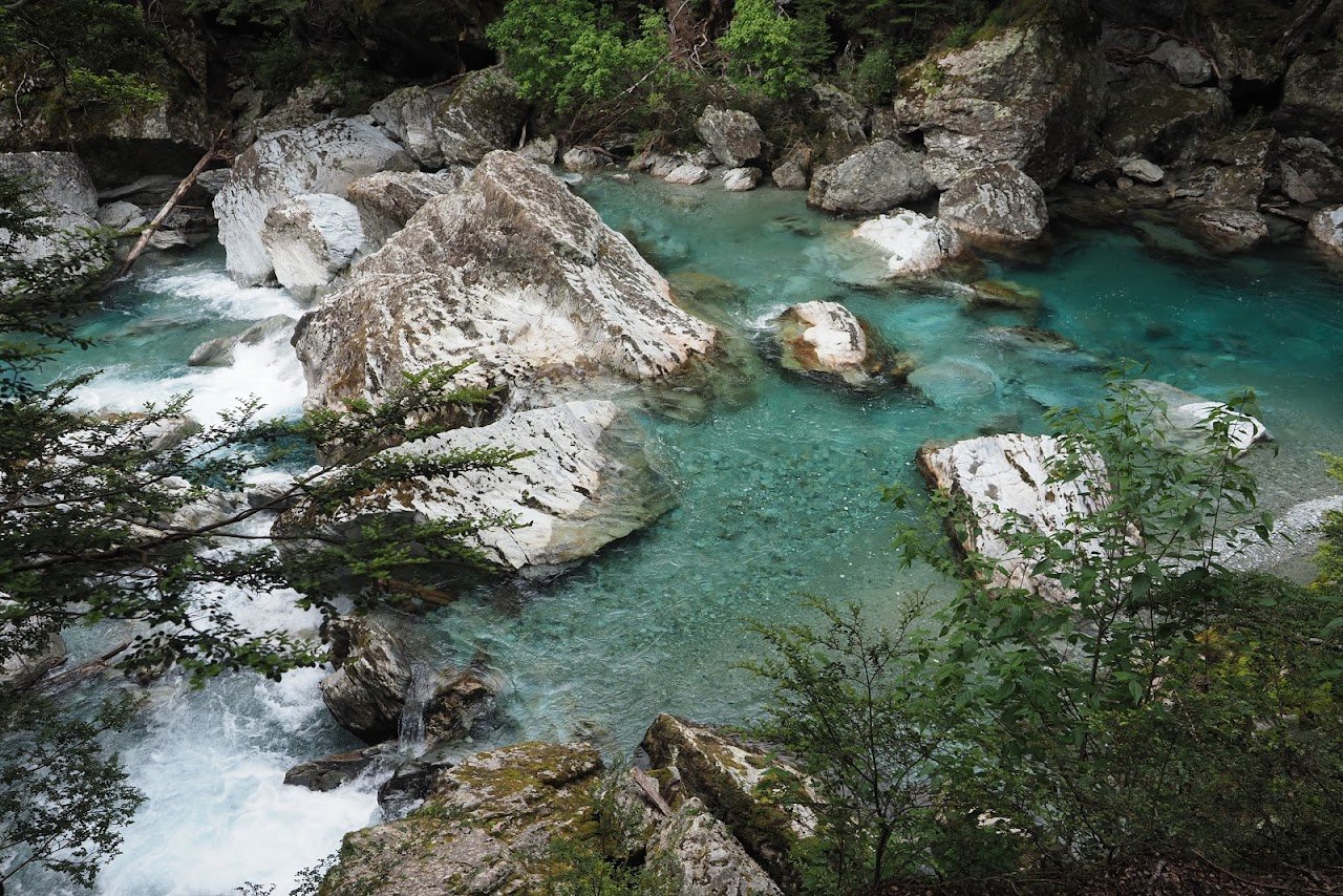
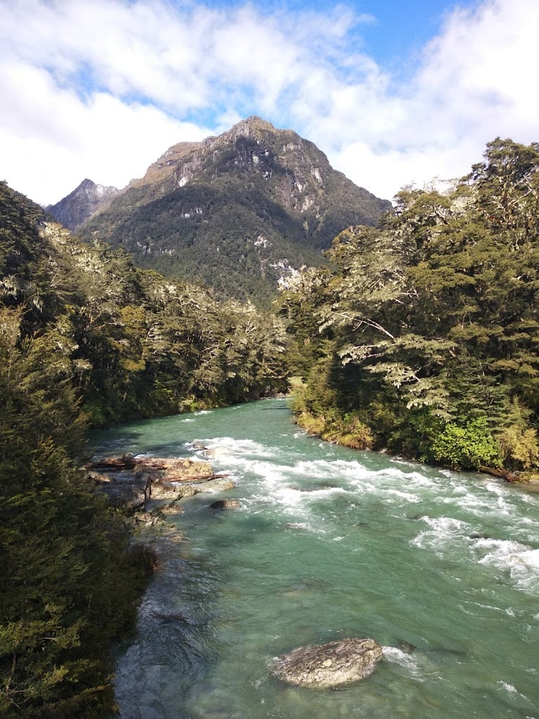
The walk along the Routeburn River is super beautiful and the colours of the water are spectacular. Once you reach the Forge Flat you will be lost for words because this is such a stunning place. If you're brave enough you can go for a dip in the ice cold water. Only the look of it with this crazy greenish/turquoise colour and being crystal clear will probably not let you resist to jump in."
Read more in:
Mentioned in these guides
About Routeburn Track
Get the inside scoop on Routeburn Track from local experts, travel creators, and tastemakers. Browse genuine trip notes, Routeburn Track reviews, photos, travel guides, and itineraries from real travelers and plan your trip with confidence.

Save this spot for later or start mapping out a new trip today
Try our AI Travel Assistant and get instant answers to any questions about your trip.
Ask ThatchGPT