Hiking Slieve Donard - Northern Irelands Highest Peak
Introduction
Slieve Donard at 850m (2,789 ft) is the highest peak of the Mourne Mountain range located on the North East coast of Ireland and the highest peak in Northern Ireland. This majestic mountain is located close to the east coast and as such gives phenomenal views of both the landscape and the sea.
Parking for the Hike
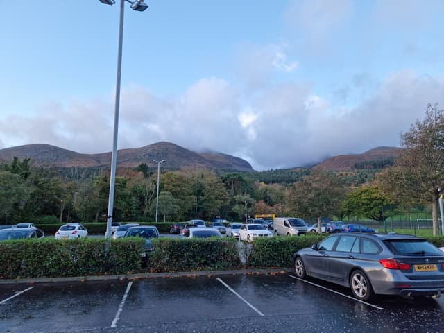
The trail head for this hike is located in the town of Newcastle on the Eastern coast of Co. Down. There is a large and un-paid carpark at Donard Park where the trail starts.
Hike details
This is a 8.9km out and back hike following a clear trail. It is generally considered a moderate to challenging climb and will take a person of average fitness approximately 5 hours to complete. The total elevation of this hike is 850m (2,789 ft). The trail starts at sea level and rises gradually to the saddle where it begins to rise more agressively.
The terrain is rocky with only a few muddy/wet areas. Crude steps have been fashioned out of the native rock of the trail to make for easier climbing on the steeper sections. This use of native rock means that the trail doesnt stick out from the landscape and ruin the beauty of the mountain.
The Hike
The hike starts from the carpark in Donard Park. This green gradually slopes upwards towards the looming peaks of the Mournes. From the carpark you will be able to hear the Glen River flowing on the left hard side of the green. The hike follows the river until you reach the saddle of the mountain. The trail beside the river can be a little wet initially if there has been some rainfall.
The winding trail follows along the right bank of the river initially, the crosses to the left bank on a small stone bridge before gradually moving uphill through Donard forest park. The river is quite clear for Irish waterways and is a popular swimming spot for locals.
After approximately 700m of climbing through quite thick forest, you emerge beside a small stone bridge. Cross this bridge, going from left to right and the trail continues, now on the left side of the river. Here the landscape is more open and populated with a lot of Scott's pines.
For this 500m~ section you have two choices, follow the main path, which is quite muddy, or walk along the small trail on the bank of the river (no more than 5m from the main path). This section of the river features many rapids, small waterfalls and inviting swimming holes.
This section of trail ends on another fire road, crossing this road you continue on the stone trail on the right side of the river. A view of the saddle of the mountain begins to emerge as you climb steadily at a comfortable incline along this trail.
After a short time, the river valley begins to deepen, dropping away from the path and giving the hiker a beautiful view down the gully into the water. The forest also falls away and now you can clearly see the saddle of the mountain and the trail winding its way up the slope.
Crossing the river using stepping stones, you now begin on the first true climb of the hike. An approximately 500m section that takes you from the river valley in the saddle of the mountain to the top of the saddle. This section is quite a hard pull (for the person of average fitness) but there are ample places to stop and take in the view and there is a spring that you can refil your water from about halfway up.
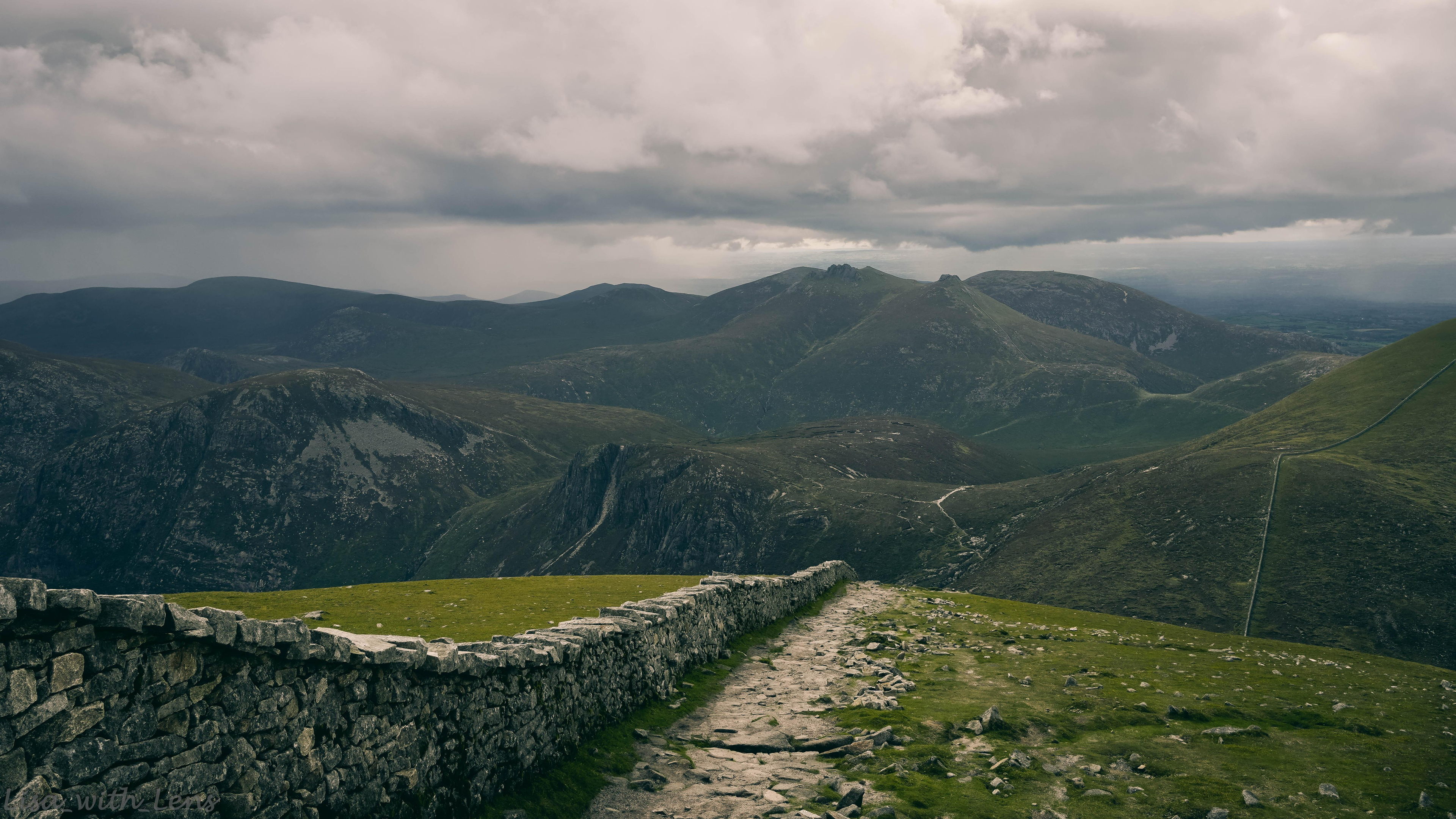
On summiting this section, you emerge onto the top of the saddle between Slieve Donard (on your left) and Slieve Commedagh (on your right). There is also a beautiful view of the Mourne mountain range stretching away ahead of you.
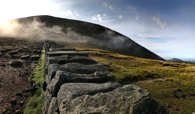
The Mourne wall, an approximately 31.4km wall which was built in the early 20th century to keep livestock from contaminating water supplies now stretches ahead of you, running both to the peak of Slieve Donard and to the peak of Slieve Commedagh. The path to the peak follows this wall to the left.
The climb beside the Mourne wall is the most challenging climb of this hike. This is an approximately 1km stretch of quite intense incline. There are plenty of grassy stopping points along the climb where you can have a breather and take in the views.
On the summit there is a small tower with the trig point on top. On a windy day the wall provides some shelter that you can sit in to eat your picnic. The views from the summit are spectacular and it is possible to see as far as the Isle of Man and Scotland on a clear day.
The hike back down is much faster, though the rocks can be slippery when wet so descend with caution. The beautiful views expand before you and guide you back down the same path you ascended.
What to bring on the hike
A waterproof coat and if possible waterproof over-trousers.
Snacks, it is approximately a 5 hour hike so a quick source of energy (chocolate bar, sandwich etc) will be a great help.
A camera or way to take photos.
A swimsuit and towel if you are brave enough to swim in the river.
A warm layer.
Water!
Mobile phone. Garmin inReach or other method of contacting help should you sustain an injury.
Small bag to pack out your tissues, wrappers or other rubbish.
Clothing suggestions
While we saw many people heading off on this hike with no more than a t-shirt, runners and sweat pants on, it is not advisable when undertaking a hike of this size in a country with such changeable weather.
It is recommended that you wear a t-shirt made of anything other than cotton. Ideally a quick drying sports t-shirt or merino wool t-shirt. Cotton is notorious for sucking the warmth out of your body and staying wet for a long time after a rain fall.
Layers are recommended. A fleece as well as a coat and waterproof bottoms if it is a particularly wet day. The wind chill on top, even in summer is quite bad.
I wore shorts for the hike in August and this was fine coupled with a fleece and with the backup of waterproof over-trousers.
Sturdy hiking boots are also recommended. The footing is quite rough and can be wet in parts. Wearing good boots will keep you warm, dry and comfortable.
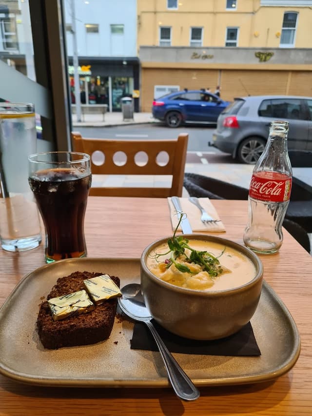
Where to eat before/after the hike
After our 5 our hike up Slieve Donard we were starving and happened upon a little gem of a cafe on Newcastle. This cafe is an excellent place to get breakfast before your hike or to refuel after your hike like we did.
All photos used in this guide are copyrighted and belong to lisa_with_lens. For more photos and videos of Ireland, check out my Instagram @lisa_with_lens.
The home for unique & authentic travel