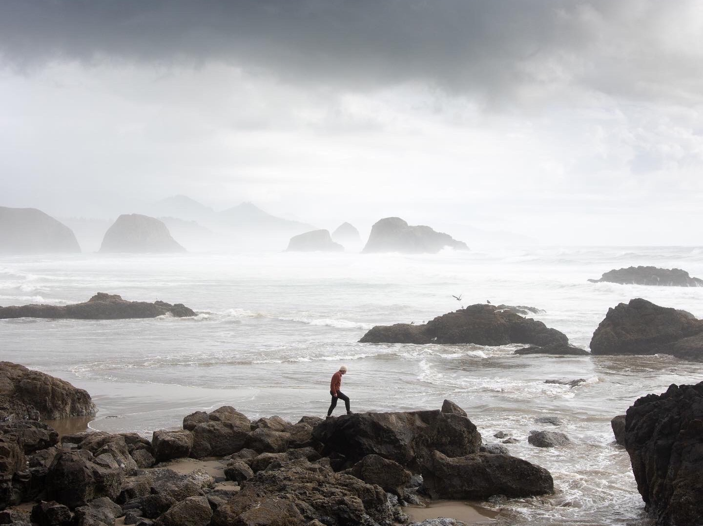
North Oregon Coast
Several of the suggested locations are near high drop offs, or can be dangerous to venture in poor weather conditions. Always follow posted warning signs and be aware of tidal shifts.
Keep the coast beautiful. Always be respectful of wildlife and plant growth when traveling the coast. pack out and leave no trace.
Locations are listed North to South, directions will correspond as if traveling South down the 101.
Astoria Megler Bridge
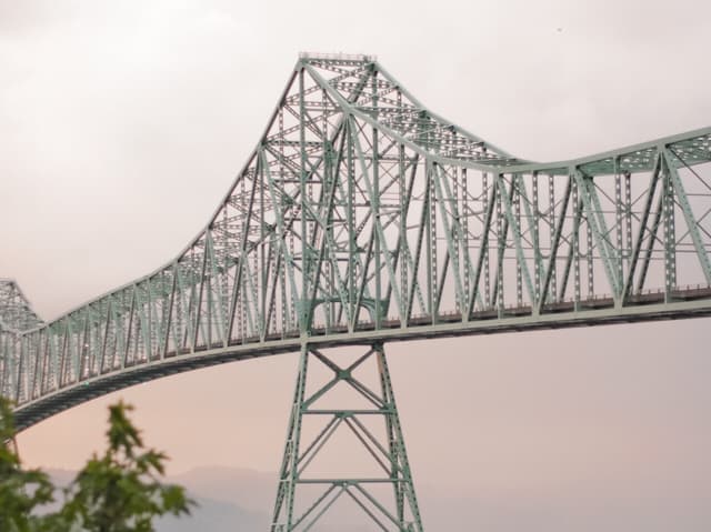
Overview
The Astoria-Megler Bridge is a great start to any Oregon coast trip. Spanning 4 miles across the Columbia river into Washington state, it’s truly an awesome sight.
Directions
It’s hard to miss
Wreck of the Peter Iredale
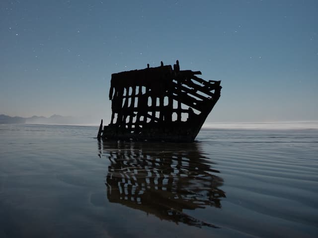
Overview
Located right off of the main road in Fort Steven’s State Park, shipwreck is an easy and historically rich start to any Oregon Coast trip. The ship is best viewed at low tide and is spectacular on a clear night under the stars.
Directions
From Astoria, travel south along the 101 and take the first exit on the roundabout across bridge. Once across the bridge, turn right onto E Harbor Dr for 2.2 miles. Continue straight at the stop sign onto N Main Ave for an additional 1.3 miles. At the curve, keep right onto Pacific Dr for 2.2 miles. At the blinking stop light, turn left onto Lake Dr (becomes NW Ridge Rd) for 1.8 miles. Turn right onto Peter Iredale Rd for 0.3 miles and then turn left to continue onto Peter Iredale Rd for an additional 0.8 miles. The road will lead straight to a parking lot overlooking the shipwreck and the Pacific Ocean.
Sunset Beach
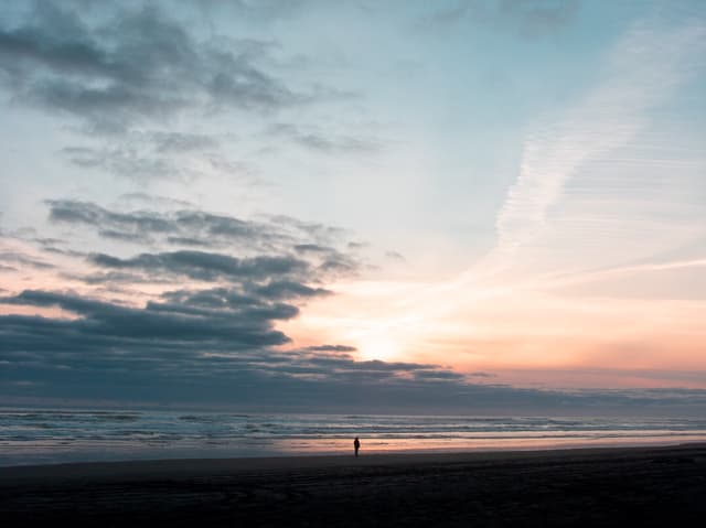
Overview
Sunset Beach located between Warrenton and Seaside, is a great place to see the sunset on a clear night. It’s also a section of driveable beach, great for a getaway, and an evening fire.
Directions
Take US-101 S to Sunset Beach Ln and turn right. Continue straight for an additional 0.5 miles and the road will dead end at the beach entrance.
Ecola State Park
Overview
Ecola State Park is one of the most beautiful locations on the north coast. Diverse plant life and wildlife make it a coastal dream. Hiking, surfing, bird watching, and many other activities all can be done within this amazing park.
Directions
Drive south on the 101 and exit at the first Cannon Beach exit onto N Fir St. At the stop sign turn right onto E Fifth St, then turn right onto Ecola Park Rd. Enter Ecola State Park.
Indian Beach
Overview
Located within Ecola State Park, Indian Beach is one of the best surf spots on the north coast. Home to several unique ocean species, Indian Beach’s tide pools are full of life.
Directions
Drive south on the 101 and exit at the first Cannon Beach exit onto N Fir St. At the stop sign turn right onto E Fifth St, then turn right onto Ecola Park Rd. Enter Ecola State Park and continue on. Before the Ecola Point viewing area, turn right at the pay station towards Indian Beach. After an additional 2.0 miles, the parking lot for Indian Beach will be at the end of the road where the beach can be accessed by a set of stairs.
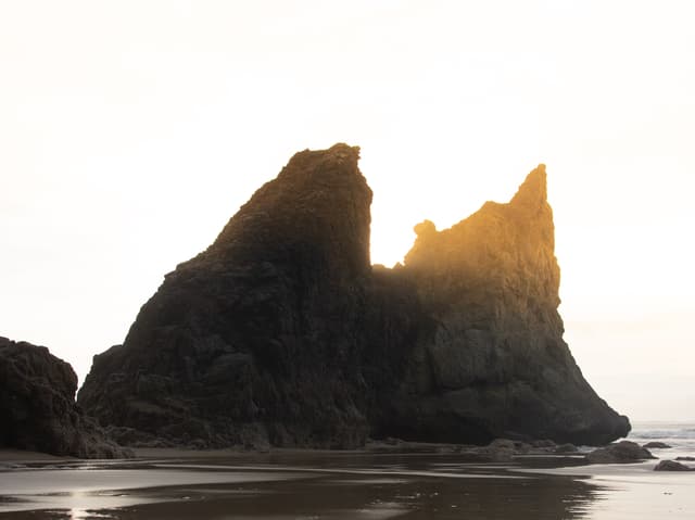
Thassophile Point
DISCLAIMER: This spot can only be accessed during low tide, only recommended for experienced hikers.
Overview
Thassophile Point is a sea stack right off of Ecola Point and can be hiked to via the Crescent Beach Trail. This location is best to visit during midday or sunset, but be prepared to hike back in the dark. Delicate sand formations and plant life can be found on the sea stack, be respectful and leave no trace.
Directions
Crescent Beach
Overview
Crescent Beach is one of the most secluded beaches on the north coast. Because of the hike required to get there, not many people decide to make it a bucket list destination. It is best to visit any time of day, due to the lack of people. Sea stacks and abundant wildlife make the trek down to Crescent Beach worth it.
Directions
Crescent Beach can be most easily accessed through Ecola State Park (refer above). Turn left at the pay station and park at the Ecola Point viewing area. Begin the journey at the trailhead near the bathrooms. The Crescent Beach trail will follow the Oregon Coast trail through the woods for 1.0 mile before making a sharp right off of the Oregon Coast trail straight down to the beach for an additional 0.25 miles (3.6 mile round trip hike).
Cannon Beach
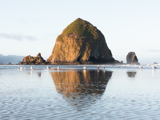
Overview
Haystack Rock on Cannon Beach is one of the most iconic locations on the north coast. Being such a popular spot, it’s best to visit during sunrise or sundown for the best views and least people. Cannon Beach is a very popular bird watching area, sometimes puffins can be seen nesting in the spring and early summer.
Directions
Haystack Rock can be accessed off of the 101 in downtown Cannon Beach. Continue south on the 101 and exit right onto Sunset Blvd. Next, turn right onto S Hemlock St. Lastly, turn left onto W Gower St and find parking. Follow the road down to the beach (behind the Wayfarer Restaurant).
Arcadia Beach
Overview
Arcadia Beach, known for its iconic rock formations, is an easy walk from the parking lot. If at the correct position, Haystack Rock can also be viewed in the distance.
Directions
Continue south on the 101. Turn right into the Arcadia Beach parking lot. Walk down the set of stairs to the beach.
Cape Falcon
Overview
Cape Falcon has some of the coast’s most impressive overlooks. With only 623 ft of elevation gain, it’s a relatively simple treck. Start the hike early to avoid crowds and enjoy the sunrise.
Directions
Cape Falcon is accessed by the Cape Falcon Trail, a 4.6 mile round trip hike. Continue south on the 101 and park at the Cape Falcon Trailhead on the right (may also be known as Short Sand Beach trailhead or Necarney Creek trailhed). Hike the trail to Cape Falcon.
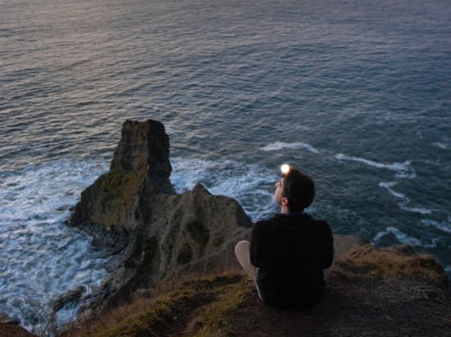
Devil’s Cauldron
DISCALIMER: 800-1000 ft cliffs, steep drop offs can be dangerous especially in adverse weather conditions, please follow posted warning signs.
Overview
Devil’s Cauldron, arguably one of the most dangerous locations on the coast, can be unforgiving. High cliffs and intense swells make it a high risk, high reward viewpoint. It’s one of the best hammocking spots on the coast if heights aren’t an issue.
Directions
Devil’s Cauldron can be hiked to via the Elk Flats Trailhead, a small parking lot off of the 101 between Arch Cape and Manzanita (0.5 mile round trip hike).
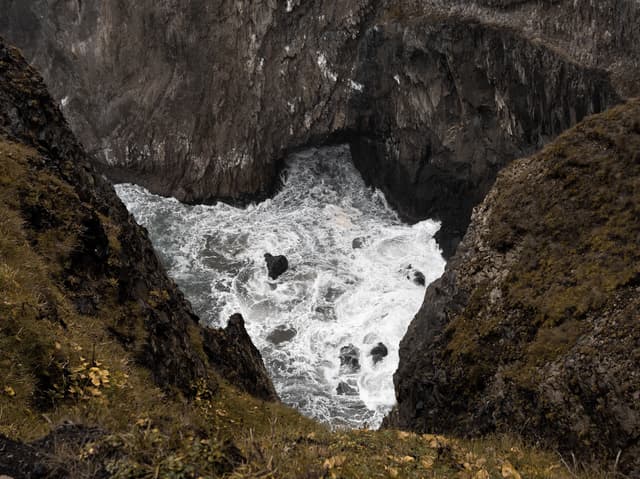
Elk Flats Trail
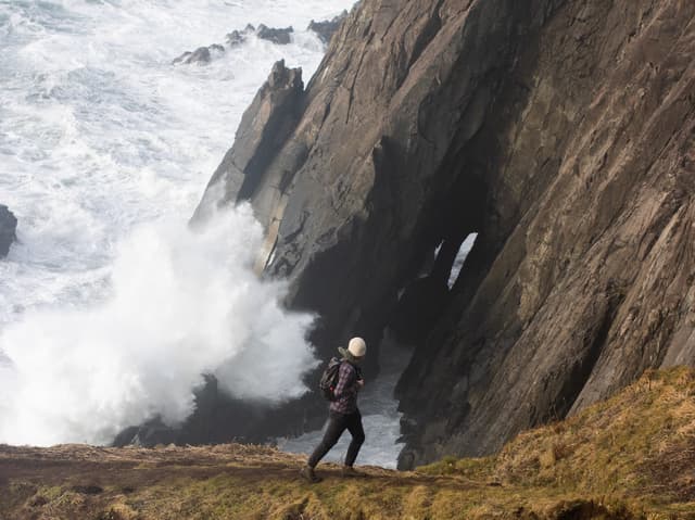
Overview
Elk Flats is one of the most visually rewarding, but dangerous locations on the coast. Some of the most dramatic sea swells can be seen at this viewpoint. A perfect high adrenaline spot to have a picnic, or a quick hike to see some killer waves.
Directions
The viewpoint at Elk Flats can be accessed via the Elk Flats Trail (refer above). As the trail splits keep left and it will lead all the way to the viewpoint (0.4 miles round trip).
Resources


The home for unique & authentic travel